CASE STUDY
UNHCR's uses Geospatial Solutions for Informed Humanitarian Action and Enhancing Refugee Relief Efforts
Sector : Public Safety and Security I Geography : Africa I Country : Sudan
Case Study
UNHCR's uses Geospatial Solutions for Informed Humanitarian Action and Enhancing Refugee Relief Efforts
UNHCR's uses Geospatial Solutions for Informed Humanitarian Action and Enhancing Refugee Relief Efforts
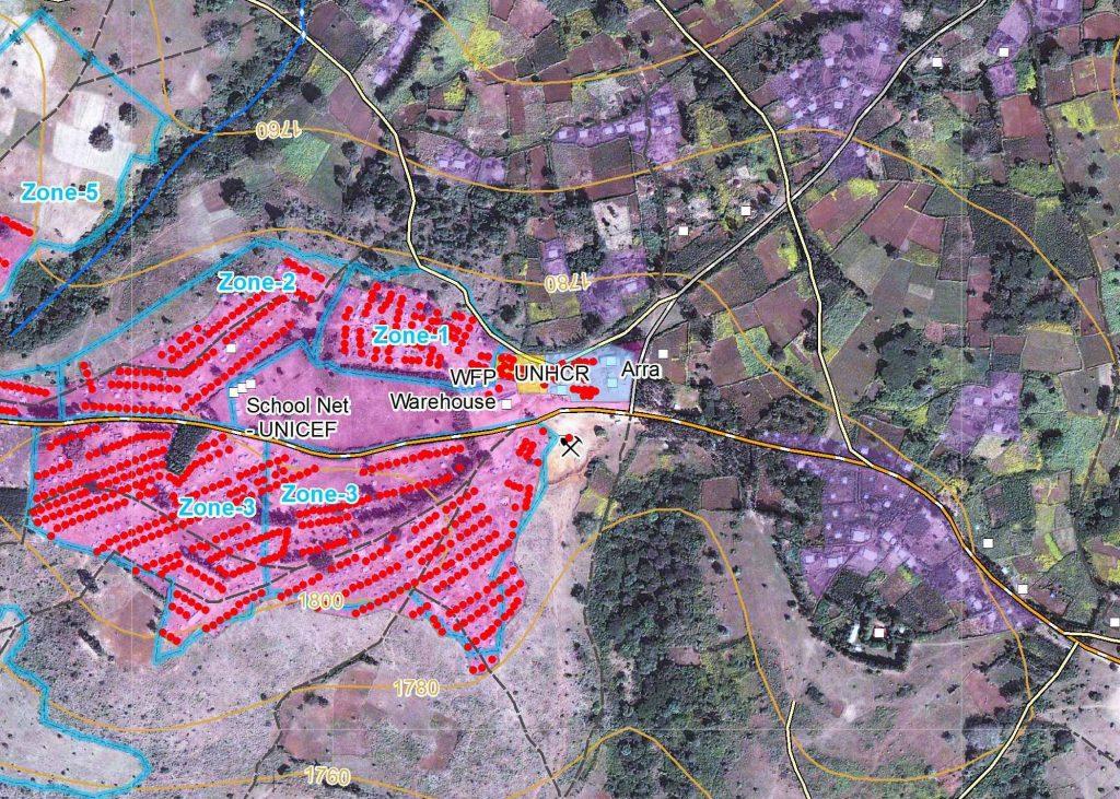
Source: European Space Imaging
Amidst the enduring refugee crisis resulting from civil conflict in Sudan, the United Nations High Commissioner for Refugees (UNHCR) has embraced geospatial technologies to enhance monitoring and assistance for displaced populations. Collaborating with industry leaders such as Maxar and GISAT, UNHCR employs satellite imagery, Geographic Information Systems (GIS), and remote sensing techniques to monitor refugee movements, assess camp infrastructure, and evaluate environmental impacts. Geospatial solutions serve as a cornerstone in bolstering the efficiency and efficacy of humanitarian aid endeavors, especially in navigating the intricate challenges of refugee relief operations within conflict-stricken areas.

United Nations High Commissioner for Refugees (UNHCR)

Maxar Technologies; GISAT; WorldView Global Alliance; Services and Applications for Emergency Response (SAFER); Emergency Response Services GMES