CASE STUDY
Smart Angat: Transforming Urban Management through GIS Technology and Digital Twin Integration
Sector : Architecture Engineering and Construction I Geography : Asia-Pacific I Country : Philippines
Case Study
Smart Angat: Transforming Urban Management through GIS Technology and Digital Twin Integration
Smart Angat: Transforming Urban Management through GIS Technology and Digital Twin Integration
Source: GIM International
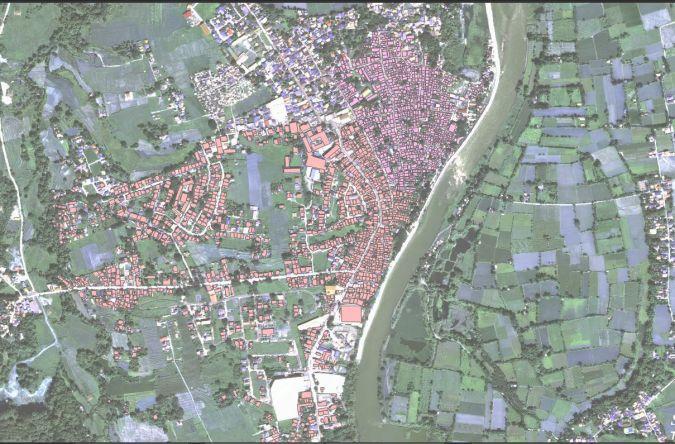
The Smart Angat project is a groundbreaking initiative aimed at addressing urban management challenges in the town of Angat, Philippines, using advanced GIS technology and a comprehensive digital twin system. Implemented in three phases, the project integrates data such as updated building footprints, cadastral maps, taxation data, and geohazard information into a unified platform. Phase 1 focused on establishing basemaps, mapping road networks, and initiating digital connectivity with citizens. Phase 2 involves updating the Comprehensive Land-use Plan (CLUP) to comply with national regulations and assess hazards. Phase 3 will integrate IoT data like CCTV, flood sensors, and air-quality monitors into the digital twin for real-time decision-making and monitoring.
Data input, processing, and output are streamlined using SuperMap GIS tools, with visualizations accessible via online portals and mobile devices. A web-based query application allows taxpayers and business owners to check payment statuses conveniently. The project enhances urban planning, disaster preparedness, taxation, waste management, and agricultural monitoring, making governance more efficient and citizen centric.

Municipality of Angat, Bulacan

Geomares; SuperMap Software Co., Ltd.