CASE STUDY
Revolutionizing Infrastructure Development: UAV LiDAR Mapping for Trans-Sumatra Toll Road Project
Sector : Architecture Engineering and Construction I Geography : Asia-Pacific I Country : Indonesia
Case Study
Revolutionizing Infrastructure Development: UAV LiDAR Mapping for Trans-Sumatra Toll Road Project
Revolutionizing Infrastructure Development: UAV LiDAR Mapping for Trans-Sumatra Toll Road Project
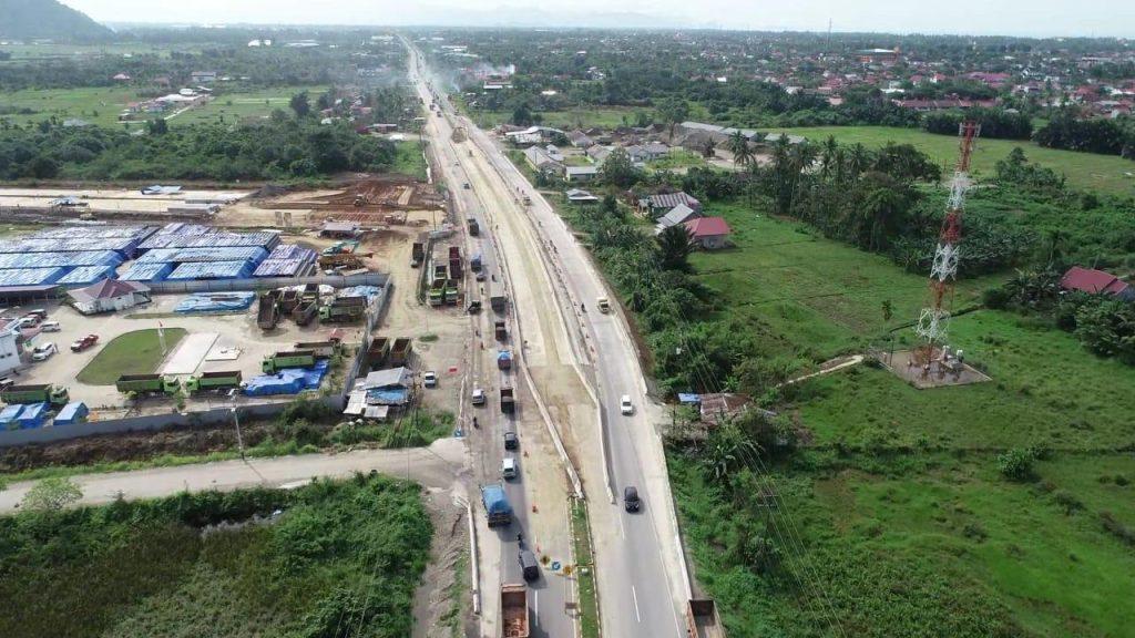
Source: YellowScan
The Trans-Sumatra Toll Road Project is a monumental infrastructure development spanning 2,200 kilometers, connecting Banda Aceh in the northwest to Bandar Lampung in the southeast. To support this initiative, Hutama Karya, a state-owned Indonesian infrastructure company, utilized cutting-edge UAV LiDAR technology to conduct corridor mapping for road construction planning.
The project relied on the Quantum-Systems eVTOL Tron UAV integrated with the YellowScan Surveyor Ultra LiDAR sensor to map dense tropical forests, hilly terrains, and challenging environmental conditions. Divided into 260 flight missions, the survey achieved unprecedented efficiency by covering 10-12 km per flight. The integration of LiDAR technology enabled precise data acquisition, even in dense vegetation, resulting in a highly accurate digital terrain model (DTM) and digital surface model (DSM).
This innovative approach ensured the successful mapping of the toll road corridor while maintaining productivity, accuracy, and cost-efficiency.

Hutama Karya

Quantum-Systems GmbH; Hexagon AB (Leica Geosystems); YELLOWSCAN
