CASE STUDY
Revealing Hidden Histories: LiDAR-Assisted Archaeological Survey of L’Escalère Hillfort
Sector : Architecture Engineering and Construction, Natural Resources and Environment I Geography : Europe I Country : France
Case Study
Revealing Hidden Histories: LiDAR-Assisted Archaeological Survey of L’Escalère Hillfort
Revealing Hidden Histories: LiDAR-Assisted Archaeological Survey of L’Escalère Hillfort
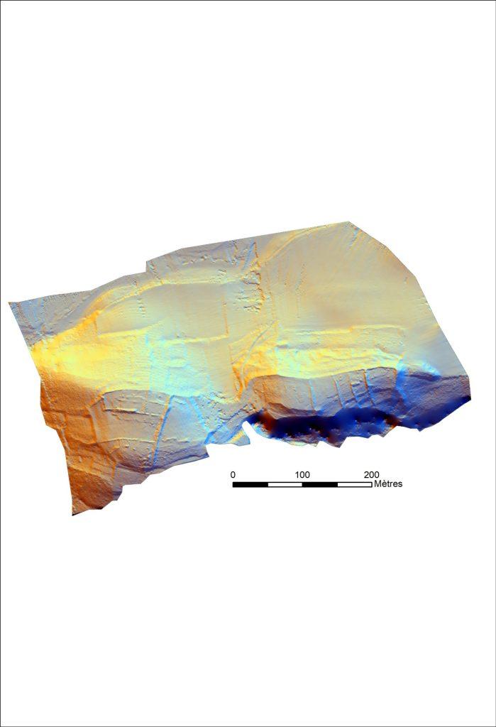
Source: YellowScan
The UMR 5608 TRACES Lab undertook a detailed LiDAR survey of the L’Escalère archaeological site near Saint-Martory, France, using the YellowScan Mapper 2 mounted on a DJI M600 drone. The 17-hectare site, located in a dense forest, hosted pre-Roman and Roman occupations, and was difficult to map using traditional methods. The primary objective was to create detailed 3D digital terrain models (DTMs) and identify micro-reliefs and structures such as walls, terraces, and anomalies.
The survey involved a single day of planning, a day of data acquisition with three 10–12-minute flights, and three days of data processing. Flying at 50 meters above ground level and at a speed of 4 m/s, the team captured a dense point cloud with over 120 points per square meter and accuracy of 1-2 cm. The processed data revealed numerous archaeological features, including Iron Age fortifications and modern agricultural boundaries, enabling efficient planning and excavation.

UMR 5608 – Traces, Université de Toulouse

YELLOWSCAN; DJI; Esri