CASE STUDY
Red-Edge Intelligence: Satellite-Driven Precision Monitoring of Oil Palm Tree Health in Malaysia
Sector : Natural Resources and Environment I Geography : Asia-Pacific I Country : Malaysia
Case Study
Red-Edge Intelligence: Satellite-Driven Precision Monitoring of Oil Palm Tree Health in Malaysia
Red-Edge Intelligence: Satellite-Driven Precision Monitoring of Oil Palm Tree Health in Malaysia
Source: Airbus Space Solutions
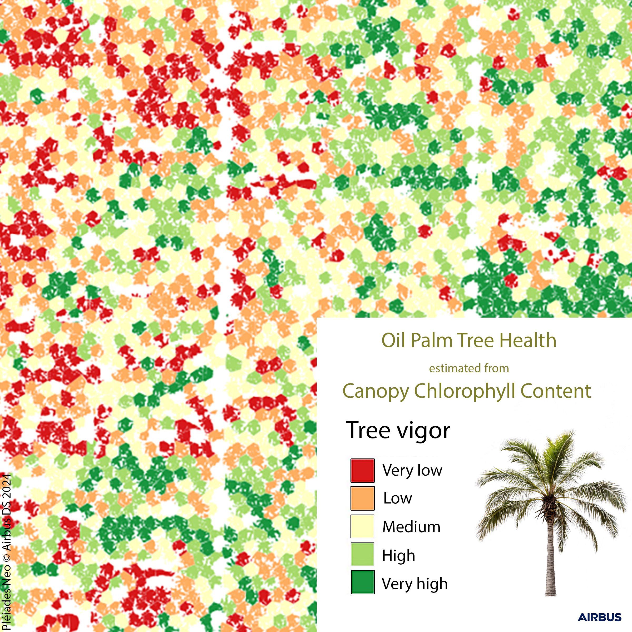
The Malaysian Space Agency (MYSA), under its National Space Policy 2030, is deploying advanced remote sensing solutions to support Malaysia’s agricultural resilience by monitoring oil palm tree health a sector vital to national food security and economic stability. Using the Pléiades Neo satellite system, MYSA applies imagery enriched with the Red-Edge spectral band, which is highly sensitive to chlorophyll content, thereby serving as a precise proxy for plant vitality.
Through the Tree Density Calculator, an open-source GIS tool, MYSA analyzes tree crown delineation and estimates tree density for each plot within oil palm plantations. The high-resolution satellite data enables monitoring down to the individual tree level, allowing for detailed mapping of chlorophyll content, or Canopy Chlorophyll Content (CCC). This approach offers a plantation-wide health map that pinpoints areas of vigor and areas requiring intervention helping planters detect issues such as pest invasion, poor soil fertility, or inconsistent fertiliser distribution.

Malaysian Space Agency (MYSA)

Airbus