CASE STUDY
Optimizing Port Operations Through Inertial Navigation Systems
Sector : Architecture Engineering and Construction, Location-Based Services I Geography : Global
Case Study
Optimizing Port Operations Through Inertial Navigation Systems
Optimizing Port Operations Through Inertial Navigation Systems
Source: GPS World
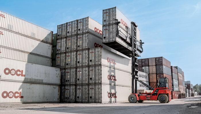
The Kalmar SmartPort project exemplifies the convergence of geospatial technologies with port automation, revolutionizing cargo handling efficiency. Leveraging Inertial Navigation Systems (INS) and GNSS, the project optimizes container tracking and terminal operations. Equipped with ruggedized receivers and industrial-grade IMUs, it ensures precise positioning even in challenging environments, enhancing operational continuity and safety. Seamless integration with Terminal Operating Systems (TOS) enables real-time data analytics, driving insights for route optimization, resource allocation, and automation. This innovative approach sets new standards for sustainability in global cargo handling, empowering ports to navigate towards a smarter, more resilient future.

Cargotec Corporation (Kalmar Global)

Septentrio N.V.