CASE STUDY
Modernizing Bridge Maintenance with Handheld RTK Scanning
Sector : Architecture Engineering and Construction I Geography : Middle East I Country : Turkey
Case Study
Modernizing Bridge Maintenance with Handheld RTK Scanning
Modernizing Bridge Maintenance with Handheld RTK Scanning
Source: infrastructuResilience
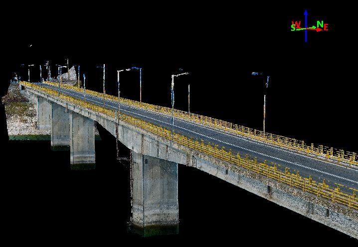
Atay, a leading Pix4D partner in Turkey, utilized the latest handheld GPS rover technology for the inspection of a historic stone bridge in Ankara, Turkey. The viDoc RTK rover, coupled with the PIX4Dcatch app, facilitated accurate site scanning using photogrammetry and LiDAR data collection. This innovative approach aimed to assess the condition of the old stone bridge, listed under historic preservation, to determine if any maintenance work was required. The project aligns with Ankara's city-wide efforts to preserve cultural heritage and history through modern surveying techniques.

Atay Engineering Technical Operations San. and Tic. Ltd.

Pix4D SA