CASE STUDY
LiDAR-based Mapping for Restoring Citrus Groves under the National Resources Conservation Service Program
Sector : Natural Resources and Environment I Geography : North America/Central America/Caribbean I Country : USA
Case Study
LiDAR-based Mapping for Restoring Citrus Groves under the National Resources Conservation Service Program
LiDAR-based Mapping for Restoring Citrus Groves under the National Resources Conservation Service Program
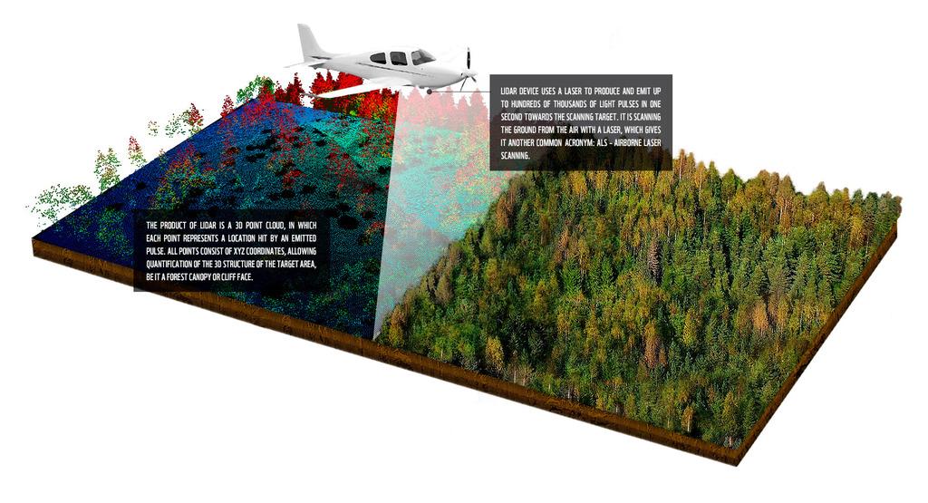
Source: Remote Sensing for Biodiversity & Conservation
The Natural Resources Conservation Service (NRCS) requires precise geospatial data to design conservation and restoration strategies. Axim Geospatial provided these services for NRCS, gathering data such as property boundaries, easements, infrastructure, elevation, and aerial imagery. Axim (now NV5) supported restoration and conservation efforts spanning over 1000 acres of citrus farms in two remote and complex sites in southern Florida. These farms featured rowed groves, irrigation channels, and extensive infrastructure. Axim conducted surveys and created maps to meet NRCS requirements. The project sites were historically wetlands, presenting additional challenges due to their remote locations, irregular terrain, and dense vegetation.

National Resources Conservation Service, U.S. Department of Agriculture

NV5 Global, Inc.