CASE STUDY
Integrative Urban Planning Using GIS: Sustaining Growth and Community in Sandy Springs
Sector : Architecture Engineering and Construction I Geography : North America/Central America/Caribbean I Country : USA
Case Study
Integrative Urban Planning Using GIS: Sustaining Growth and Community in Sandy Springs
Integrative Urban Planning Using GIS: Sustaining Growth and Community in Sandy Springs
Source: American Planning Association
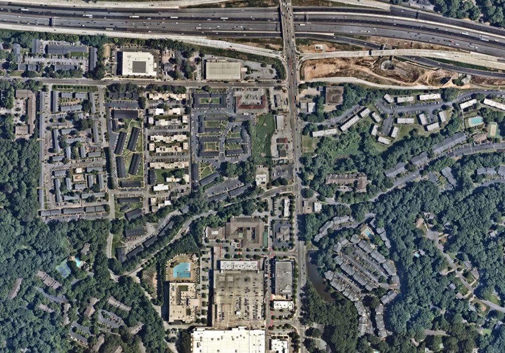
The project focuses on transforming Sandy Springs, Atlanta into a sustainable, inclusive, and forward-looking urban space using GIS technology and public collaboration. Rapid urban growth challenges the city to maintain its unique cultural fabric while addressing the demands of millennials and longtime residents. Central to the project are the Crossroads neighbourhood and City Green areas that highlight issues like gentrification, flooding risks, and mixed-use zoning concerns. GIS-based tools provide stakeholders with realistic 3D models of proposed changes, illustrating how developments will look and function, ensuring community engagement, and fostering transparency.
The Crossroads Small Area Plan emphasizes housing preservation, walkability, and open space, balancing growth and cultural preservation. The City Green redevelopment incorporates mixed-use spaces, retaining scenic views while promoting economic and cultural activities. AI-driven tree canopy analysis safeguards green spaces, while GIS simulations forecast changes in population, employment, and resources.

City of Sandy Springs

Esri