Geospatial Solutions for Urban Flood Risk Management
Source: Fathom
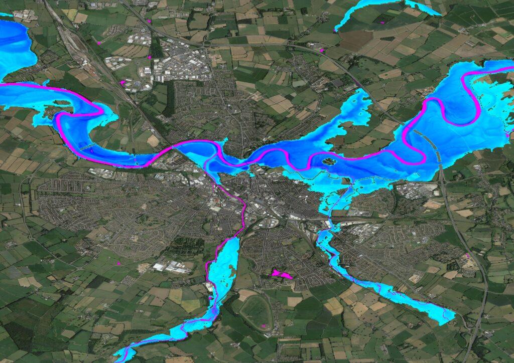
PYRAMID, a collaboration between leading academic institutions and technology providers, has emerged to restructure flood risk management in response to the growing threat of urban flooding. Leveraging geospatial technologies such as LiDAR, aerial photography, and artificial intelligence in collaboration with Bluesky International Ltd., this project aims to address the limitations of traditional flood modeling approaches and enhance resilience in urban areas. By employing hyper-resolution modeling techniques and real-time data integration, stakeholders are empowered with unprecedented insights into localized flood risks, enabling more informed decision-making and proactive mitigation strategies.

Newcastle University; Loughborough University

Bluesky International Ltd