CASE STUDY
Geospatial Revolution: Enhancing Construction Management at La Cima
Sector : Architecture Engineering and Construction I Geography : North America/Central America/Caribbean I Country : USA
Case Study
Geospatial Revolution: Enhancing Construction Management at La Cima
Geospatial Revolution: Enhancing Construction Management at La Cima
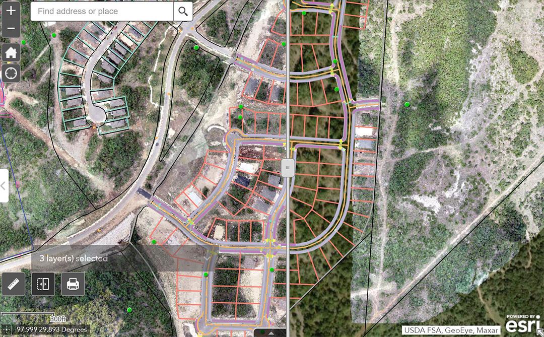
Source: Esri
La Cima, a vibrant 2,400-acre community nestled between San Antonio and Austin, Texas, embarked on an ambitious construction project to develop 2,000 single-family lots and numerous amenities. To address the challenges of managing such a vast project site and ensuring effective communication among stakeholders, the development team leveraged cutting-edge geospatial technology. Weekly UAV imagery captured by TXDronePics, coupled with precise ground control points established using GNSS receivers, formed the basis for a comprehensive construction management system powered by ArcGIS Online. This system facilitated real-time data sharing, project monitoring, and analysis, enhancing project visibility and efficiency.

Natural Development Austin, LLC

Texian Geospatial, LLC.; Eos Positioning Systems®, Inc.; Tom Peden