CASE STUDY
Fugro's Contributions to the Seafloor Mapping Initiative in Florida's Coastal Waters
Sector : Natural Resources and Environment, National Mapping I Geography : North America/Central America/Caribbean I Country : USA
Case Study
Fugro's Contributions to the Seafloor Mapping Initiative in Florida's Coastal Waters
Fugro's Contributions to the Seafloor Mapping Initiative in Florida's Coastal Waters
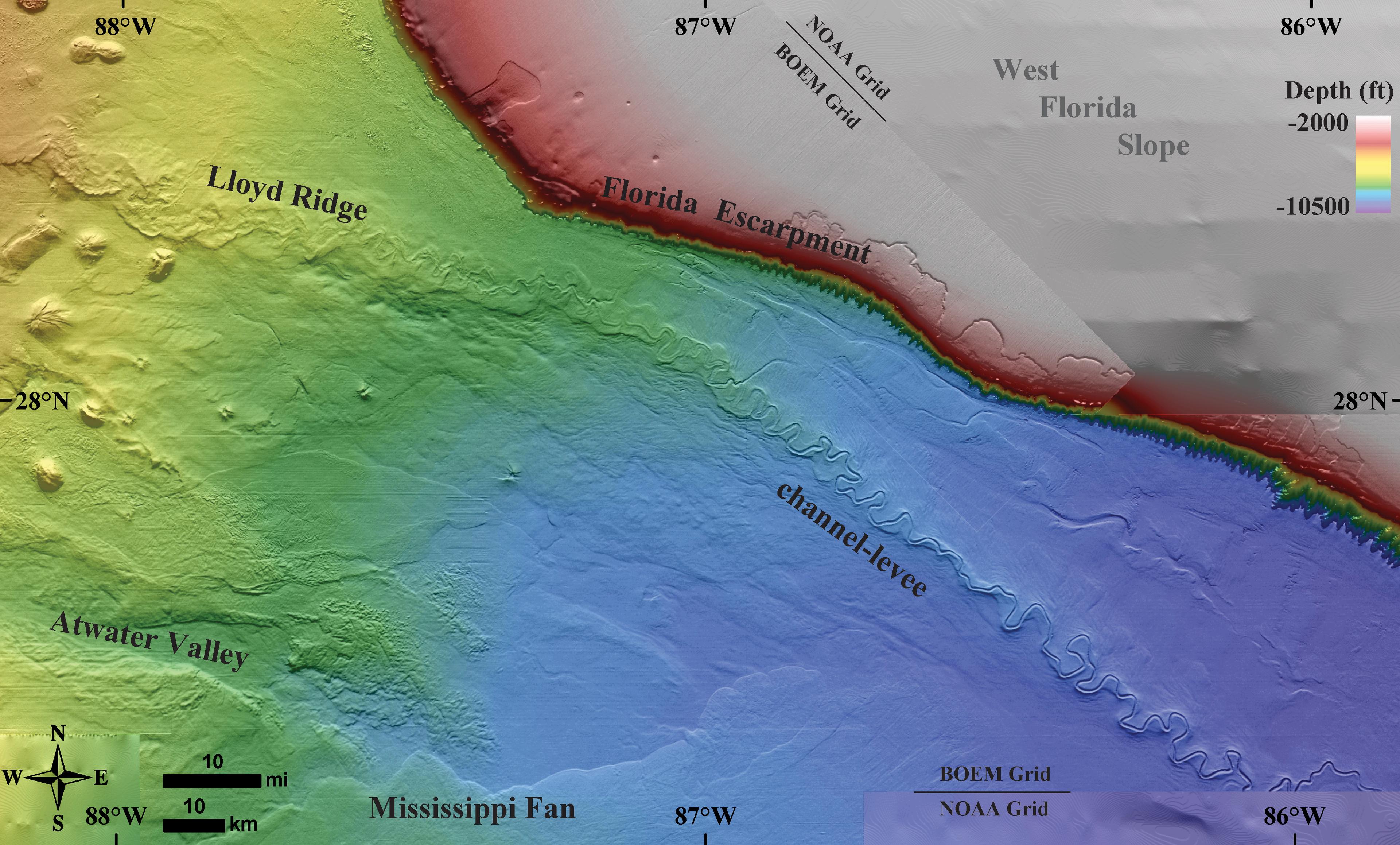
Source: Bureau of Ocean Energy Management
Fugro, in partnership with the Florida Department of Environmental Protection (FDEP), is leading the Florida Seafloor Mapping Initiative (FSMI) to comprehensively map the Atlantic coastal waters of Florida from Georgia to Miami. This initiative is designed to furnish essential Geo-data for climate adaptation strategies, habitat mapping, environmental restoration, and coastal hazard studies. Fugro's task order centers on bathymetry utilizing airborne lidar technology, notably employing the Rapid Airborne Multibeam Mapping System (RAMMS).

Florida Department of Environmental Protection

Fugro