CASE STUDY
Enhancing Volcanic Disaster Management with SAR Imagery
Sector : Natural Resources and Environment, Public Safety and Security I Geography : Europe I Country : France
Case Study
Enhancing Volcanic Disaster Management with SAR Imagery
Enhancing Volcanic Disaster Management with SAR Imagery
Source: Smithsonian Institution
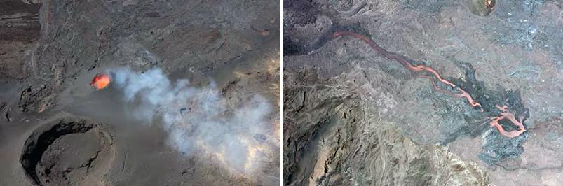
From September 19 to October 5, 2022, Piton de la Fournaise volcano in the Indian Ocean erupted, sending lava flowing over 3 km down its slopes. Capella Space, in collaboration with remote sensing scientists, provided daily SAR observations to volcano observatories, enabling the prediction of lava flow paths and enhancing safety measures. By combining spaceborne and ground-based monitoring, new strategies are emerging to better protect communities from volcanic hazards. Capella satellites tracked the eruption's dynamics, revealing key insights into the morphology of volcanic constructs. This collaborative effort showcases the potential of integrated monitoring for improved volcanic hazard prediction and response.

Capella Space