CASE STUDY
Enhancing Tunnel Management and Maintenance Using Advanced Geospatial Technologies
Sector : Architecture Engineering and Construction I Geography : Europe I Country : Netherlands
Case Study
Enhancing Tunnel Management and Maintenance Using Advanced Geospatial Technologies
Enhancing Tunnel Management and Maintenance Using Advanced Geospatial Technologies
Source: BIM Corner
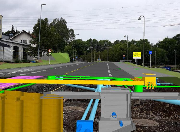
Beecot-Inspect, in collaboration with Catenda, utilized geospatial technologies for the maintenance and management of an extensive infrastructure tunnel. This project aimed to modernize traditional inspection processes through the strategic integration of AR, BIM, and geospatial technologies. Leveraging AR for precise assessment of corroded brackets, coupled with BIM for comprehensive data management, this collaboration enabled stakeholders to achieve unprecedented efficiency and accuracy in project oversight. From streamlining the tendering process to enabling remote monitoring with real-time insights, this project showcases the tangible benefits of embracing spatial intelligence in infrastructure maintenance.

Erasmus MC

Beecot BV; Catenda