CASE STUDY
Enhancing Flood Monitoring Capabilities and Agricultural System Health Assessment through Sentinel-1 Data Analysis
Sector : Natural Resources and Environment I Geography : North America/Central America/Caribbean I Country : Canada
Case Study
Enhancing Flood Monitoring Capabilities and Agricultural System Health Assessment through Sentinel-1 Data Analysis
Enhancing Flood Monitoring Capabilities and Agricultural System Health Assessment through Sentinel-1 Data Analysis
Source: U.S. Department of the Interior
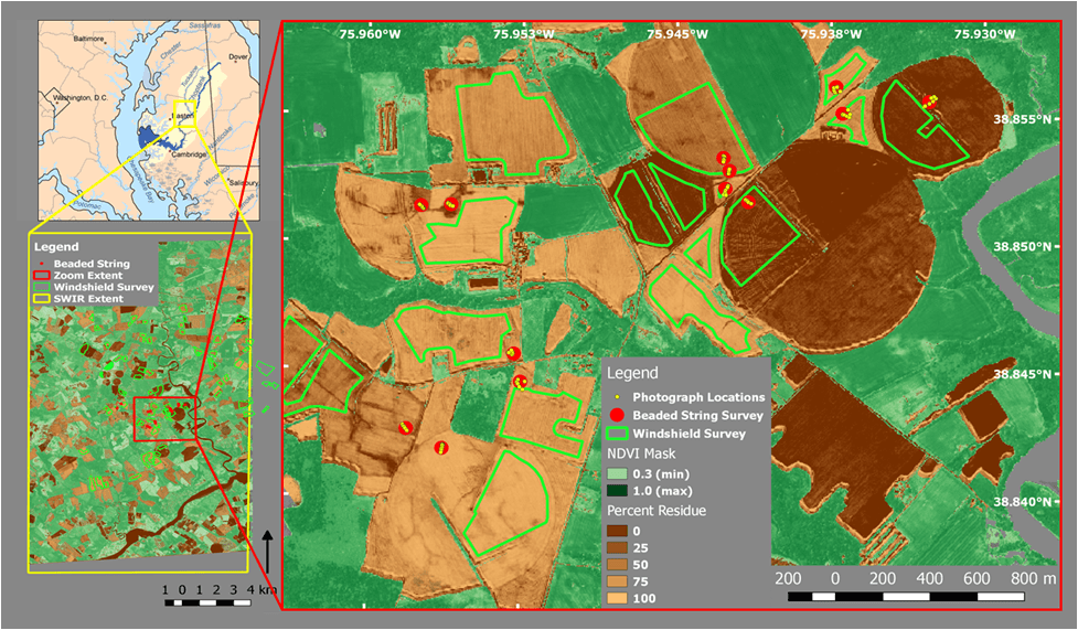
A community-based environmental organization in Southern Ontario, Canada, called Lower Trent Conservation Authority, embarked on a project to map crop residue in the area using data from remote sensing. The study demonstrates the utilization of SAR remote sensing products developed with ENVI SARscape Analytics to deliver accurate and efficient information regarding soil cover conditions in agricultural fields at the regional level. The study introduces a relative soil cover index based on both crop residues and living crops. Depending on the analyst's requirements, there are various methods available to summarize the resulting maps.

Lower Trent Conservation

NV5 Global, Inc.