CASE STUDY
Empowering Urban Planning Decision-Makers with Immersive 3D GIS Visualization
Sector : Architecture Engineering and Construction I Geography : Europe I Country : UK
Case Study
Empowering Urban Planning Decision-Makers with Immersive 3D GIS Visualization
Empowering Urban Planning Decision-Makers with Immersive 3D GIS Visualization
Source: Directions Magazine
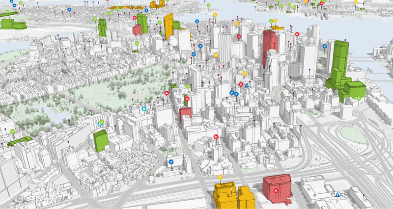
Nottingham City Council embarked on an ambitious venture to modernize its urban planning processes using geospatial technologies. Faced with the challenge of outdated 3D models and standalone GIS applications, the council sought to revolutionize its approach to planning by developing a fully interactive 3D environment. Utilizing Bluesky's MetroVista 3D mesh model product, they created an advanced visualization tool that integrates high-detail 3D data with existing geospatial datasets. This innovative solution enables planners to undertake advanced visualizations, constraint checks, and spatial analysis, while also facilitating stakeholder engagement and transparency in the planning process. The project showcases the transformative potential of geospatial technologies in enhancing decision-making, efficiency, and collaboration in urban development initiatives.

Nottingham City Council

Bluesky International Ltd