CASE STUDY
Empowering Agricultural Resilience with High-Resolution Satellite Imagery in the Philippines
Sector : Natural Resources and Environment I Geography : Asia-Pacific I Country : Philippines
Case Study
Empowering Agricultural Resilience with High-Resolution Satellite Imagery in the Philippines
Empowering Agricultural Resilience with High-Resolution Satellite Imagery in the Philippines
Source: AGRITECHTOMORROW
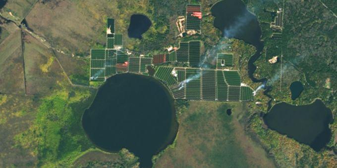
The Philippine Department of Agriculture grappled with challenges arising from incomplete and outdated satellite imagery, hindering effective agricultural planning and resource management. To address these hurdles, the Department embarked on a transformative journey leveraging geospatial applications. Teaming up with Geo-Surveys & Mapping, Inc. (GSMI) and Maxar Technologies, they harnessed high-resolution satellite imagery from GeoEye-1 and WorldView-2 satellites, ushering in a new era of precision and insight. This initiative aimed to equip decision-makers with comprehensive spatial data for streamlined resource allocation, vulnerability assessment, and climate change adaptation. Through meticulous analysis of historical imagery and advanced geospatial techniques, the Department paved the way for sustainable agricultural development, establishing a benchmark for informed decision-making and resilient ecosystems.

Department of Agriculture, Philippine

Maxar Technologies; Geo-Surveys & Mapping, Inc.