CASE STUDY
Dynamic GIS-Based Public Safety Management for Championship Events
Sector : Public Safety and Security, Governance I Geography : North America/Central America/Caribbean I Country : USA
Case Study
Dynamic GIS-Based Public Safety Management for Championship Events
Dynamic GIS-Based Public Safety Management for Championship Events
Source: Esri
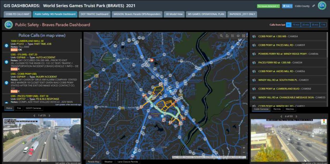
Cobb County, Georgia, demonstrated cutting-edge public safety management during the 2021 World Series and subsequent victory parade. With minimal preparation time, the county leveraged GIS technology and real-time data integration to manage a dynamic, high-density environment. The GIS system provided situational awareness, enabling the coordination of 100,000+ attendees across a 100-acre area and ensuring a smooth flow of traffic and crowds. The system integrated multiple datasets, including traffic data, rideshare activity, security staff locations, and live 911 calls, into comprehensive dashboards. For the parade, GIS maps were used to plan routes, manage crowd proximities, and oversee officer placements in real time, ensuring public safety and minimal disruption. These tools also supported stealth operations by plainclothes officers using smartphone-based apps.

Cobb County Government

Esri