CASE STUDY
Arctic Navigational Safety Initiative: Mapping Submerged Hazards and Enhancing Route Planning with Satellite Tools
Sector : Natural Resources and Environment, Public Safety and Security I Geography : Europe I Country : Denmark
Case Study
Arctic Navigational Safety Initiative: Mapping Submerged Hazards and Enhancing Route Planning with Satellite Tools
Arctic Navigational Safety Initiative: Mapping Submerged Hazards and Enhancing Route Planning with Satellite Tools
Source: Deep Ocean Education Project
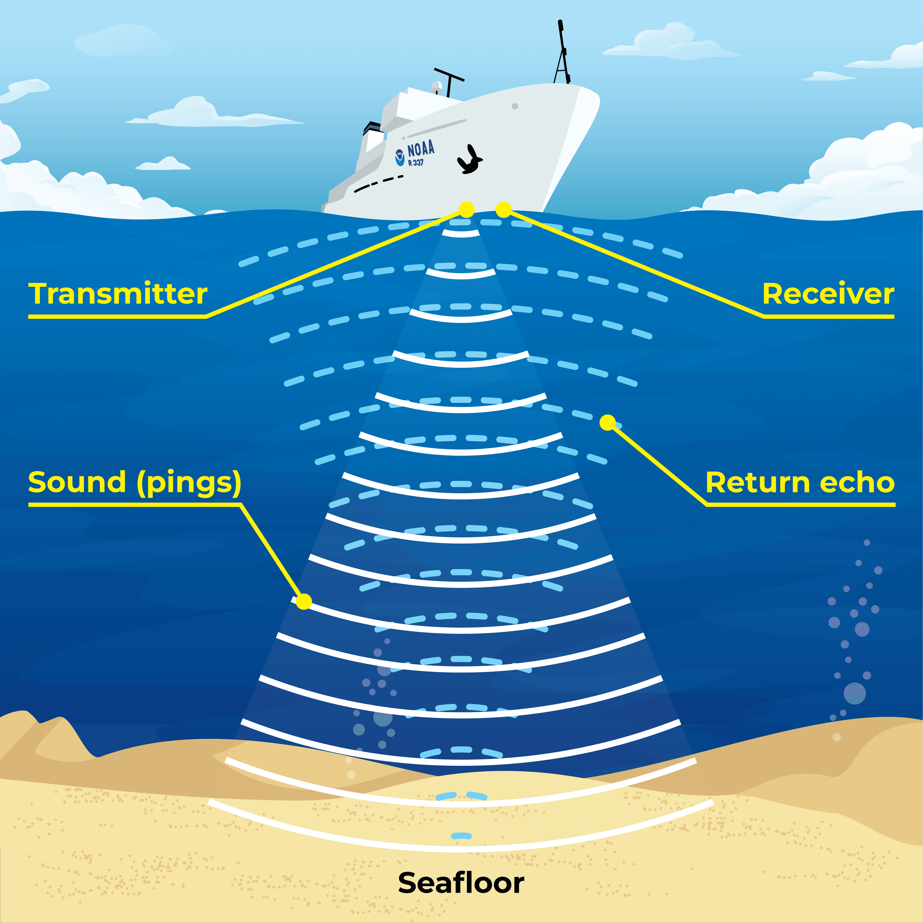
In response to the challenges of navigating Arctic waters, a collaborative effort between the Royal Danish Navy and DHI has led to the development of NANOKnavi – a satellite based tool. This satellite-data-based tool provides detailed maps of submerged hazards, improving safety in Greenland's coastal Arctic waters. By integrating local knowledge and leveraging advanced technology, NANOKnavi empowers mariners to navigate safely through remote and poorly-charted areas, enhancing the resilience of local communities and protecting the fragile Arctic marine environment.

The Royal Danish Navy; DHI A/S

NAPA – The Nordic Institute in Greenland; Nordic Arctic Cooperation Programme-Nordregio